
Sources for Pleasant Grove Neighbors
A safe block lookup starts with spatial records. A parcel map shows surrounding lots. A property abstract adds recorded parties and instruments. A plat can show the legal layout. Voter fields are regulated and are not a public street roster. A historical directory or newspaper may show a dated household or business mention. Community association registration can identify an association name, but not members.
| Source | What it shows about a block | Access |
|---|---|---|
| County Parcel Map | Adjacent parcel shapes, layers, owner search, historic map view | Free reference viewer |
| Land Records abstract | Parcel serial, situs, mailing line, parties, instruments | Online; office route |
| Tax-parcel GIS layer | Polygon data and OWNER_NAME display field | Public service query |
| Plat / HOA record | Subdivision lots, association or development instruments | County or Commerce search |
| Voter record | Permitted registration and precinct fields | Individual or regulated request |
| Historical source | Dated address, event, institution, or past household clue | Library, Archives, newspapers |
“Neighbor” has a useful records meaning: an adjacent parcel, lot on a plat, or property inside a selected map distance. It does not mean every person whose mailing address shares a street. Use parcel serials and spatial terms when documenting the block.
Map a Pleasant Grove Block
The County Parcel Map accepts an address or common place, serial, owner name, and PLSS township, range, and section. It supports street abbreviations and directional terms. The interface includes layers, basemap, historic parcel date, print, export, and support panels. Start at one known address, then work outward to adjacent parcels. The process creates a map-backed set of parcel connections, not a private household roster.
- Enter the address and confirm the selected parcel and serial.
- Record the map date, situs line, and any boundary or layer used.
- Click adjoining parcels and note their serials rather than copying unnecessary personal detail.
- Open the abstract or property view for the parcel question, keeping owner and mailing lines distinct.
- Use a plat, public notice, or city code when the informal name of a block needs proof.
For the full named-street record chain, switch to the Pleasant Grove street directory. The neighbors workflow stops at the immediate block and its spatial context.
Pleasant Grove Liberty Grove Story
An inspected Liberty Grove PUD abstract shows how a local subdivision can appear through multiple document roles. Plat, HOA, easement, deed, trust-deed, lender, and related entries may share one parcel timeline. That pattern helps identify the legal shape of a block and the documents behind it. It does not turn every named party into a neighbor or resident.
The Utah Commerce HOA Registry can identify a legal association name, registration, contact update, or annual filing. The research did not locate a public membership roster. Use a recorded plat to define the physical subdivision, then use the registry only for the association’s legal record. Do not seek or publish private member lists.
| Utah Commerce HOA Registry | Legal association name, registration, and contact-update status. |
|---|---|
| Recorded plat | Subdivision lots and physical layout in county records. |
| Public membership roster | Not located in the inspected sources; do not imply one exists. |
The Liberty Grove abstract is the source for this crossover.
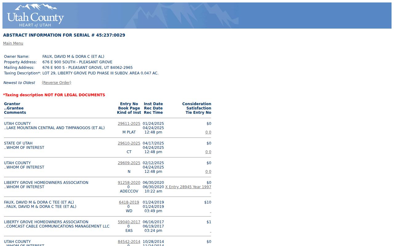
The image illustrates why an abstract should be read by document type and date.
Pleasant Grove Parcel Lines
The county GIS tax-parcel service publishes polygon parcels and an OWNER_NAME display field. A property abstract may show a mailing line and a situs line. Those are property and notice fields, not an occupancy guarantee. A person listed as owner may live elsewhere, and a household member or renter may not appear in the parcel record.
Keep three statements separate: the map places a parcel, the record names a party, and a separate source may show a dated presence. If two addresses look alike, preserve the original directional and unit text. The city’s Main and Center grid can help interpret a street, while USPS can standardize the mailing line. Neither source identifies a household.
A visible map result is strongest when cited with its parcel serial, source date, and layer. Do not publish a bulk list of nearby names simply because a map makes them easy to click.
- Adjacent parcel
- A parcel that shares a boundary with the starting parcel on the map.
- Plat
- A recorded map that lays out lots, streets, and subdivision relationships.
- Buffer
- A selected map distance around an address, whose current output needs verification.
The county tax-parcel service provides the layer schema and query context.
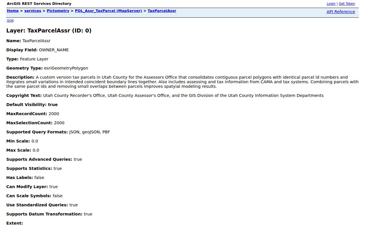
It is a parcel data service, not a public neighbor directory.
Pleasant Grove ZIP and Precinct
These four labels do not describe the same geography. ZIP 84062 is the official Pleasant Grove association in Utah’s list, but UGRC calls ZIP polygons approximate delivery areas. County precinct maps list Pleasant Grove identifiers 301, 302, 303, 304, 306-314, and 316-326. A precinct is an election boundary, not a neighborhood. A subdivision is a plat or development concept. A city boundary is an incorporated place line.
For a block question, retain postal city, ZIP, municipality, county, precinct, parcel serial, and subdivision as separate fields. If an address is near an edge, use USPS and county GIS at the address level. Nearby 84003 or 84042 references do not establish a citywide overlap. The county precinct map route is useful for the election layer only.
Local geography tip. Use the Parcel Map for adjacent lots, USPS for delivery text, UGRC for an approximate ZIP display, and the city code for the Main-and-Center numbering rule.
Pleasant Grove Public Notices
Pleasant Grove public notices can show a development proposal, neighborhood discussion, or agenda topic. A March 24, 2026 notice mentions Sam White’s Lane Neighborhood and a proposed bank branch at 545 S Pleasant Grove Blvd. That is evidence of a public land-use record, not a list of people living nearby. Read the agenda packet and preserve its date, issuer, and status.
The city business-license register works the same way. Its 2026 PDF has account, name, phone, location, mailing address, owner, activity, license period, and type. It can show a dated organization-location connection. It cannot prove that a license holder lives at the location. Current permit, inspection, and code-case search fields were not verified, so a GRAMA request should name the department, address, date range, and record type.
Pleasant Grove Historic Neighbors
Older neighbors may be a family, shop, school, church, farm, or event. The 1890 Pleasant Grove Sanborn set has four sheets, and related 1907 material identifies Main, Center, numbered streets, a public school, and the Pleasant Grove LDS Church. The National Register district nomination describes approximately 112 acres and soft-rock construction. These anchors help reconstruct a block without claiming a household.
Utah Digital Newspapers returned 3,923 Pleasant Grove-filtered results. Search by street, year, institution, organization, or event, then verify the page image. A nearby name in a newspaper may describe a business or meeting rather than a home. A directory entry is also a snapshot. Save its page and date.
For a person-specific question, use the Pleasant Grove resident lookup route and its confidence labels. For an old address, use the previous-residents workflow rather than treating a historical map as an owner record.
Pleasant Grove Block Evidence Trail
A clear worksheet moves from address to map, parcel serial, abstract, plat, and dated companion source. Keep the original street wording, normalized USPS line, county situs, legal description, parcel date, and source URL. Write the reason for any normalization. This preserves a trail through directional abbreviations, subdivisions, and possible edge cases.
- Map the starting address and adjacent parcel shapes.
- Use serials to open only the records needed for the question.
- Label owner, mailing, plat, HOA, lender, and historical roles correctly.
- Compare ZIP and precinct fields without treating them as neighborhood names.
- Stop when the source answers the question, and remove extra personal detail.
The Utah County Parcel Map sample is the visual starting point for this block method.
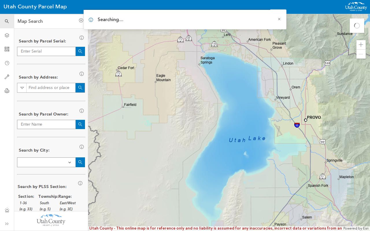
The county property-notification map is listed as a GIS tool, but its exact radius and output were not inspected. Do not promise a buffer result until the current interface confirms it.
Official and Compiled Neighbor Sources
Official parcel, plat, voter, and city records have a named custodian and a stated purpose. Compiled commercial neighbor tools may merge public filings, old addresses, and purchased data. They can be stale or join same-name people, and they do not replace the county map or the correction route of the source agency.
| Source type | Strength | Limit |
|---|---|---|
| County parcel and abstract | Named parcel, map, recorded party | Not a household roster |
| City or association record | Dated administrative or legal association context | Membership or occupancy not established |
| Compiled neighbor tool | May combine many data points | Source date and accuracy may be unclear |
Privacy Limits for Neighbors
Public records do not expose every household member, renter, utility customer, delivery customer, or DMV address. DMV data is controlled by federal DPPA rules. Safe at Home and voter At-Risk procedures can protect address-related information, and the Utah Consumer Privacy Act does not erase government records. A map’s ease of access does not expand the lawful purpose of a record.
Lawful use. Pleasant Grove neighbor research is for parcel context, genealogy, civic curiosity, reconnecting through safe channels, and personal safety awareness. Do not use it to watch, follow, threaten, harass, or intimidate anyone.
If the goal changes from a block to one person, use the smallest official source and keep the record date. If a result is wrong, contact the custodian that owns the field. A no-result or withheld result may reflect privacy, coverage, or a protected classification.